
When every minute can determine the outcome of a rescue, technology becomes more than an efficiency tool—it becomes a lifeline.
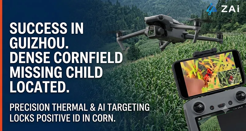
In early August 2026, a remarkable rescue in Guizhou Province, China, once again demonstrated the growing importance of search and rescue drones in emergency response. After nearly 80 hours missing in mountainous terrain, a 4-year-old autistic boy was successfully located alive. According to reports from China National Radio (CNR) and local rescue authorities, drones played a decisive role in identifying the child's location within dense cornfields on a mountain ridge, enabling ground teams to reach him quickly. (Source: https://baijiahao.baidu.com/s?id=1872597475263424158&wfr=spider&for=pc)
The incident is not only a touching story of hope, but also an important case study for emergency agencies worldwide. As climate change increases extreme weather events and outdoor activities continue to grow, governments and rescue organizations are increasingly investing in enterprise drone solutions, thermal imaging UAVs, and AI-powered emergency response systems to improve search efficiency while reducing risks to rescue personnel.
For HongKong Global Intelligence Technology Group Limited, this rescue highlights a broader industry trend: modern industrial drones are rapidly becoming indispensable assets in search and rescue (SAR), disaster response, wildfire management, and public safety operations.
Mountain rescues remain among the most difficult emergency operations worldwide.
Unlike urban searches, wilderness environments introduce multiple uncertainties that severely limit conventional search methods.
In the Guizhou incident, rescuers searched through extensive cornfields and forested mountain terrain.
Vegetation creates multiple layers of visual obstruction:
Corn exceeding two meters in height
Dense tree canopy
Bushes and undergrowth
Uneven terrain hiding individuals from line of sight
Even trained rescue teams may pass within only a few meters of a missing person without detecting them.
Search strategies depend heavily on understanding human behavior.
Children with Autism Spectrum Disorder (ASD) often respond differently from neurotypical individuals.
Common behavioral characteristics include:
Avoiding unfamiliar voices
Remaining silent despite nearby rescuers
Seeking concealed locations
Limited response to whistles or loudspeakers
Increased anxiety around large rescue groups
These factors dramatically reduce the effectiveness of traditional "call-and-listen" search tactics.
Every additional hour introduces new challenges:
Dehydration
Hypothermia
Fatigue
Heat exposure
Reduced mobility
Meanwhile, rescue teams themselves face:
Difficult mountain climbing
Night operations
Navigation hazards
Physical exhaustion
Large-scale manual searches are labor intensive and expensive, especially across hundreds of hectares.

A video screenshot showing volunteers pinpointing the location of a missing child using a drone.
The advanced search and rescue drones do far more than provide aerial photography.
Today's systems integrate sensors, artificial intelligence, mapping technologies, and real-time communications into a single airborne platform.
Instead of replacing rescue personnel, drones dramatically improve where and how teams search.
One of the most valuable technologies in modern SAR operations is thermal imaging.
Unlike conventional cameras, thermal sensors detect infrared radiation emitted by warm objects.
This allows rescuers to identify human heat signatures even when visibility is poor.
Modern rescue payloads commonly feature:
640 × 512 thermal resolution
NETD below 30 mK
High frame-rate thermal video
Simultaneous RGB imaging
AI-assisted hotspot recognition
Thermal imaging is particularly valuable during:
Night operations
Dense forests
Mountain valleys
Flood zones
Earthquake debris
Searches after severe weather
Although thick vegetation can reduce detection performance, elevated viewing angles and repeated flight paths significantly improve the probability of identifying hidden heat sources.
Finding a warm object is only the beginning.
Animals, rocks heated by sunlight, vehicles, and other objects can all generate thermal signatures.
Modern AI-powered drones combine thermal data with computer vision to distinguish humans from surrounding environmental features.
Edge AI processors analyze:
Body shape
Movement patterns
Thermal distribution
Object proportions
Environmental context
Instead of overwhelming operators with hundreds of alerts, AI prioritizes high-probability targets for immediate review.
This dramatically accelerates decision-making during time-critical rescue missions.
Locating a victim visually is not enough.
Ground teams need precise coordinates.
Professional enterprise drone solutions integrate:
RTK GNSS
Laser rangefinders
Terrain elevation models
Digital mapping software
Once a target is confirmed, the drone automatically generates highly accurate GPS coordinates and shares them with command personnel.
Instead of directing rescuers toward "the large tree near the hill," teams receive exact navigation points.
This minimizes search delays after detection.
At HongKong Global Intelligence Technology Group Limited, effective SAR operations are viewed as a complete ecosystem rather than a single aircraft.
A successful deployment integrates airborne sensing, AI analysis, communications, mapping, and coordinated field operations into one workflow.
Immediately after arrival:
Launch mapping drones
Generate a 3D terrain model
Identify obstacles
Define search boundaries
Import GIS and satellite data
Historical movement models, weather conditions, terrain difficulty, and missing-person behavior can all contribute to estimating the Probability of Area (POA) for search planning.
Rather than relying on manual flight, intelligent mission planning automatically generates optimized search routes.
Mission planning considers:
Terrain elevation
Vegetation density
Flight altitude
Sensor overlap
Battery endurance
Wind conditions
For heavily vegetated regions, overlapping flight paths significantly increase detection probability.
Potential detections are verified using multiple payloads simultaneously.
Typical drone payload combinations include:
Thermal camera
40× optical zoom camera
Laser rangefinder
AI image recognition
Low-light imaging
Cross-validation greatly reduces false alarms.
Once confirmed, drones continue supporting rescue teams by:
Providing continuous overwatch
Guiding personnel through difficult terrain
Broadcasting live video
Illuminating targets during night operations
Delivering emergency supplies when appropriate
This integrated workflow significantly shortens rescue time while improving responder safety.
The technologies demonstrated in wilderness search are equally valuable across a wide range of emergency drone missions, from disaster response and flood rescue to wildfire suppression and missing-person operations.
Following earthquakes, floods, landslides, and hurricanes, drones rapidly assess inaccessible areas without exposing responders to additional hazards.
Thermal imaging remains effective through smoke where conventional cameras become nearly unusable.
Fire commanders can identify stranded civilians while monitoring fire progression.
Search drones detect survivors stranded on rooftops, isolated terrain, or floating debris while coordinating boat and helicopter deployments.
Modern sensors allow continuous operations long after helicopters or ground teams become less effective.
AI-enabled aerial monitoring can support missing-person searches during festivals, sporting events, and large public gatherings.
| Capability | Operational Value |
| Thermal Imaging | Detects human heat signatures in low visibility |
| AI Recognition | Reduces false positives and speeds identification |
| RTK Positioning | Provides precise rescue coordinates |
| Optical Zoom | Confirms targets from safe distances |
| Long Flight Endurance | Covers larger search areas with fewer interruptions |
| IP-Rated Airframe | Supports operations in rain, dust, and harsh environments |
| Integrated Mapping | Enables real-time situational awareness |
| Live Data Transmission | Improves coordination between air and ground teams |
According to industry analyses from organizations including the International Association for Search and Rescue, European Union Aviation Safety Agency (EASA), and multiple emergency management agencies, unmanned aerial systems are becoming standard equipment for:
Fire departments
Emergency management agencies
Mountain rescue organizations
Police departments
Civil protection authorities
Humanitarian relief organizations
Several studies have shown that drones can reduce search times dramatically in appropriate scenarios while improving rescuer safety and lowering operational costs. Their greatest value lies not in replacing experienced personnel, but in helping teams search smarter by covering larger areas, identifying high-probability targets faster, and maintaining real-time situational awareness.
The successful rescue of the young boy in Guizhou reminds us that every technological breakthrough ultimately has one purpose: protecting human life.
As AI, edge computing, thermal imaging, autonomous flight, and real-time communications continue to evolve, search and rescue drones will become even more capable in supporting emergency responders operating in mountains, forests, flood zones, disaster areas, and other challenging environments.
At HongKong Global Intelligence Technology Group Limited, we are committed to developing intelligent enterprise drone solutions that combine advanced sensing, AI analytics, precision positioning, and integrated command systems into complete emergency response ecosystems.
Whether supporting public safety agencies, firefighting departments, disaster management authorities, or humanitarian organizations, our mission is simple: help responders find people faster, operate more safely, and give every rescue mission the greatest possible chance of success.


 English
 français
 Deutsch
 русский
 فارسی
فارسی ไทย
ไทย العربية
 Nederland
 বাঙালি
 Македонија

